ProjectB5
From !khure
Sub-project n°B5 : The tectonic framework of Southern Africa interpreted from gravity and aeromagnetic data
French pi: A. Galdeano (with J.L. Le Mouël)
South African pi: M. Doucouré
Contents |
Project Participants
- South Africa: Rodger Hart, Susan Webb, Moctar Doucouré
- France: Armand Galdeano, Luis Gaya-Piqué, Jean-Louis Le Mouël, Erwan Thébault
- Other: Stuart Gilder (Munich), Valentin Mikhailov (Moscow)
Aims and objectives
- . To identify the major terrain boundaries (edges) including the limits of effects large impacts in Southern Africa.
- . To identify and understand the relationship between felsic (crustal) and mafic (dominantly mantle) rocks in the Earth‟s crust.
- . To apply magnetic and gravity imaging techniques to coherently map out the major structures in Southern Africa.
- . To Understand the relationship between major sedimentary basins and depth to MOHO
- . To understand the horizontal and vertical distribution of Cretaceous age magmatic/volcanic features.
- . To provide MSc training for at least one black South African student (still to be identified).
Introduction
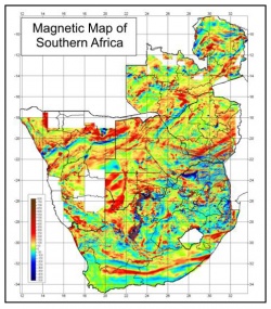
An understanding of the development of both crustal magnetization and gravity features in the crust is essential in interpreting continental scale terrain boundaries which manifest themselves either as major magnetic or gravity anomalies. In order to determine the major gravity and magnetic features in the upper 30 km of Southern Africa, we intend to apply a number of transformations e.g. block leveling and low pass filtering of the gravity and aeromagnetic data of Southern Africa. These crustal features include kimberlites resulting from magmatic events. The distribution of kimberlites will be analysed through anisotropy associated with magnetization directions.


